
Wednesday, 29 October 31 SM

A tug and tow may lurk around any bend.
If there’s any question why they built the Alligator-Pungo Canal, a quick look at the chart gives the answer. West of Tuckahoe Point, the Alligator River squiggles like a pair of Paloma Picasso earrings. It’s impossible to picture a tug-and-tow piloting those turns, even if that part of the river had the depth.
By contrast, the A-P Canal is straight as a ruler, easily twice as wide as the Dismal Canal and two to three times as deep. The Garmin often shows 18’ as Steadfast motors west-so’west at just over five-knots, ten miles to the Fairfield Bridge. There’s a slight turn to starboard, then another ten or so before she pops out into the Pungo River proper.
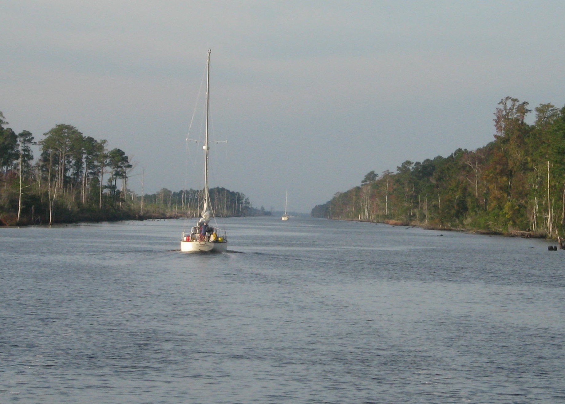
The Alligator-Pungo is another straight shot.
Acre after acre of tall pines pack the shore, swaying slightly to the southerly breeze. There’s a break here and there, filled with swamp grass of such uniform height it’s as if someone had taken a scythe to it. Then more pine. Broken stumps line the shallows on either side and, on occasion, a row of crab pot floats. But that’s it.

Stumps encroach eager to grab the unwary.
It was “anchor’s aweigh” at 0800, Steadfast pulling away from Bear Point and into the channel behind Phase II, Dream Catcher, Living the Dream and Over the Rainbow (do you see a theme here? If there’s doubt, Snowbird and Journey are up ahead, too, heard from time to time calling others on the VHF). Other than that, and the occasional powerboat passing to port, there wasn’t much to break up this leg. A real easy six hour, thirty mile run.
By 1400, Steadfast pulls up to the fuel dock—even Red, as dainty as she is, builds an appetite after a couple of days running hard—at Dowry Creek Marina, a tidy mom-and-pop kind-of-place about a mile off the ICW just east of Belhaven, NC. Twelve gallons later, and with thunderstorms forecast overnight, she pulled down the pier to a slip for what’s hoped to be a quiet night.
Kinda like the day’s run.
Steadfast out.


🙂