
Friday, 6 March
The excitement’s over. That’s it for this day, watching Sirena squeeze under the lift bridge. Once she’s through, it’s all down hill from there, just motoring up the final few miles of the St. Lucie Canal to Stuart.

A passing sailboat arouses little interest among the herd.
Not that this is a complaint, mind you. As noted previously, on a small boat, boring is good. And the waterway past Port Mayaca qualifies as “boring” in anybody’s book, just a long man-made ditch. Banks are eight, ten, 15-feet high on either side, depending. A ‘gator—first of the entire trip—lurks at the surface, sunning itself in the shallows to port. In a field off the starboard bow, a half-dozen horses graze, tails chasing churlish flies while colts cavort nearby. And, as usual, the mangroves fill with ibis in the morning.
There’s a bit of a tail wind along with a favorable current albeit slight, the result of seasonal efforts to drain Lake “O.” But that’s another story altogether, one of big money, big politics, big pollution, big controversy (see http://www.ecologyandsociety.org/vol6/iss2/art17/main.html ).
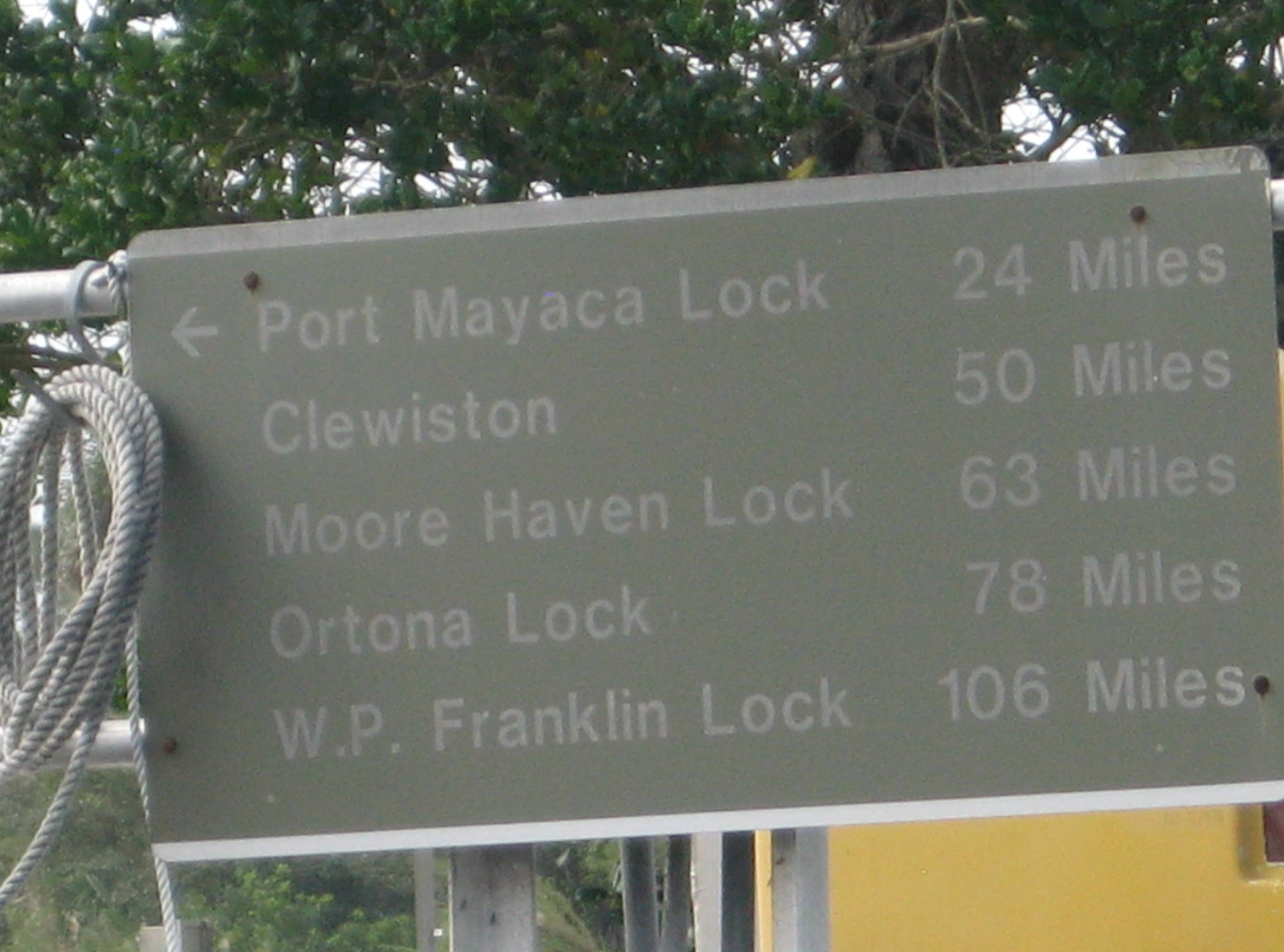
And…a hundred-thirty-five miles to Fort Myers.
That story may be the most interesting part of this stretch of the St. Lucie Canal as the waterway now is known. Go ahead. Look for a landmark. The chart shows “Swamp” on one side, “Ditch” on the other. Wait, there’s a “Spoilbank.” But then the entire canal is lined by swamp, ditch or spoilbank. Using just the chart, it’s hard to tell where you are.
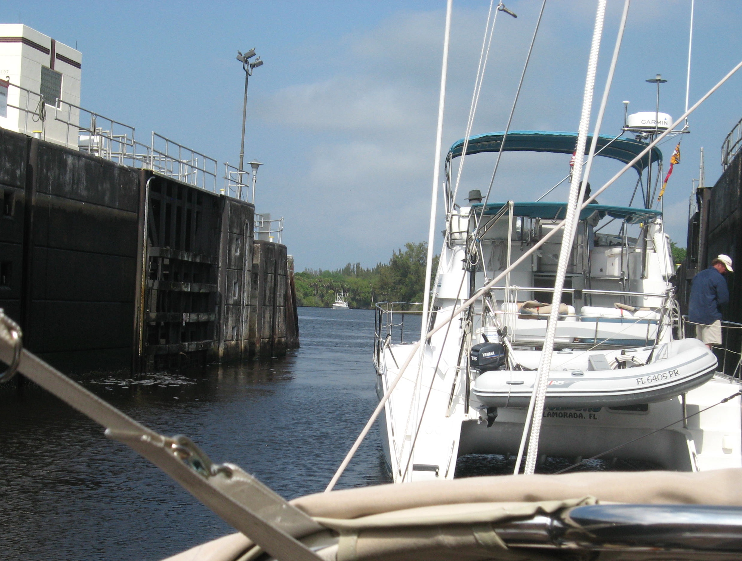
A big power cat leads the way out the St. Lucie lock.
Then again, you can’t go too far wrong. Just keep it, well, between the ditches. There’s a two-mile stretch to the first turn to port. Then it’s a straight shot to a half turn to starboard, then…well, you get the idea. There’s one straightaway that runs—I am not making this up—uninterrupted for eight (8) miles.
The big excitement comes with the approach to the St. Lucie Lock. Will Steadfast get there in time for the next lock through? A call ahead on the VHF elicits the hoped for response.
“I see ya, cap’n,” says the lockmaster. “Keep ‘er comin’.”

A local resident poses atop a piling at the pier.
And she does, indeed, keep goin’ and nestles up to the east side of the lock. Tied off there, gates gradually open and she rises 14’ to the level of the St. Lucie River. Once through the gates, Steadfast slides into the river proper, which narrows and twists and passes under a series of bridges—each 55’ tall at the center—before curving east round downtown Stuart.
The river runs on from here eastward another few miles to the ocean, St. Lucie Inlet. That’s where its waters mix with those of the ICW, the “Crossroads,” as they say.
Lovely town. Friendly folk.
A good spot to sit for awhile.
Steadfast out.


Recent Comments